AUSTIN, Texas — There’s a galaxy of gifts out there for space nerds. Researchers at The University of Texas at Austin may have just the thing to set your present apart: a model of Jezero Crater, the landing site of NASA’s upcoming Mars 2020 Rover mission, that you can 3D print yourself.
The file is free and available for anyone to download.
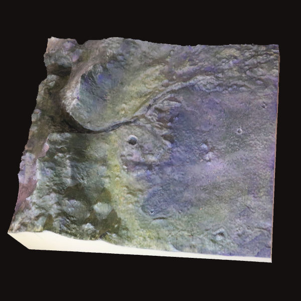
The replica shows in miniature the amazing landscape that awaits the NASA rover. It includes the sharp-peaked mountains that form the crater’s rim, a valley carved by an ancient river, and the river delta’s fan of sediments – which the Mars 2020 Rover will sample in search of potential microfossils that would show that the Red Planet was home to life billions of years ago.

“The delta is the main feature of interest, and getting a sense of how it’s spread across the landscape is really, really interesting,” said Tim Goudge, an assistant professor at the UT Jackson School of Geosciences and the lead advocate for Jezero as the Mars 2020 landing site.
The model can be scaled up or down, but the standard size is about 8 by 7½ inches, about 100,000 times smaller than the area it represents on Mars. The details of the landforms correspond to those on Mars, but the researchers increased their scaled-down height by five times so their details would be easier to see and feel. Jackson School exhibit designer John Maisano painted the model pictured here to highlight the different landforms.
UT alumnus Michael Christofferson created the file and took on the project as an undergraduate at the Jackson School. Working with Goudge and UT anthropology and geology professor John Kappelman, Christofferson developed free software that takes digital elevation data collected by the Mars Reconnaissance Orbiter, a satellite, and converts it into STL files that can be read by a 3D printer.
Goudge said feeling the model’s landscape has given him a new appreciation for the subtleties of the crater’s topography. Even after he spent the past five years poring over images of Jezero, the model allowed for new insights, such as a realization that a broad depression spreads across the floor of the crater.
“I’ve learned new things from it,” he said. “All the subtle topography that you can feel with your hand, it shows up in the data, but it’s never emphasized. Our tactile sense of learning is very different.”
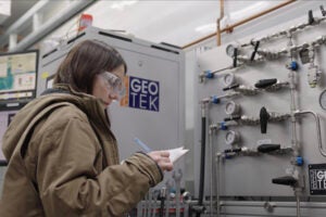
When lab manager Adrienne Witzel washed the Jezero model to remove scaffolding left over from the printing process, she said that seeing the water flow through the river valleys really brought home how the ancient crater was an active watershed billions of years ago.
“It works exactly how you would expect it to work,” Witzel said, describing how the water flowed through the valley and spread through the delta networks. “[The model] allows you to visualize data in such a way that you can participate in some really amazing stuff.”
The model’s size means it’s right at home on a desk or bookshelf (which is where Goudge keeps his copy). But Goudge said that he envisions the replica, first and foremost, as a teaching tool.
He imagines geology students using the model to better interpret Martian topography in images sent back by the Mars 2020 Rover. And in a world where space news is dominated by pictures, he said that the model could help people with visual impairments engage with Mars exploration.
“That’s another avenue where there’s huge learning possibilities,” Goudge said. “Everybody can get something out of this, and it makes it more accessible to everyone.”


