During the past decade, more than 10,000 scientists, engineers, students and other researchers have used DesignSafe to advance research on natural hazards.
As the nation’s premier cyberinfrastructure for engineering and social science research on natural hazards, DesignSafe includes computational resources, software and expertise that have been used by researchers to manage, analyze and share data about earthquakes, hurricanes, inland flooding, tornadoes, landslides and wildfires.
DesignSafe is a core component of the National Science Foundation (NSF)-funded Natural Hazards Engineering Research Infrastructure (NHERI), and it has played a transformative role in advancing research practices and collaboration in the natural hazards field.
“NHERI — and DesignSafe in particular — plays a critical role for us to perform research to improve our understanding of the consequences of natural hazards,” said DesignSafe principal investigator Ellen Rathje, a professor in the Cockrell School of Engineering’s Maseeh Department of Civil, Architectural and Environmental Engineering at The University of Texas at Austin.
The Texas Advanced Computing Center (TACC) is the engine behind DesignSafe, enabling researchers to perform advanced computational research, manage massive datasets, and collaborate across institutions — crucial for advancing natural hazards engineering.
“TACC is a partner that puts the researcher first, and they realize that it’s important to build a bridge to the natural hazards research community,” Rathje said. “We have an amazing partnership. I credit TACC and its leadership for helping DesignSafe have a successful first decade.”
Improving Building Safety After Florida Hurricanes
Using DesignSafe, scientists analyzed field reconnaissance images from the 2017-2018 hurricanes in Florida — including Hurricanes Irma and Michael — to identify critical vulnerabilities in building performance, leading to improvements in safety and resilience in future building design.

“These structures were elevated because of the water hazard, but doing so enhanced the potential for wind damage,” Rathje said.
Building on the hurricane field observations, NHERI researchers conducted controlled wind tunnel experiments at the Florida International University Wall of Wind facility, which can generate Category 5 hurricane-force winds.
Researchers tested scaled models of both elevated and non-elevated buildings, and the results confirmed the field observations — elevated structures experienced greater wind-related damage. These experiments provided critical validation of the observed trade-offs between flood protection and wind vulnerability.
“As a direct result of these findings, recent updates to the building codes now include wind loading force coefficients associated with elevated structures such that buildings built in the future will be designed better to withstand elevated wind loads,” Rathje said.
As a direct result of these findings...buildings built in the future will be designed better to withstand elevated wind loads.
Launching Wildfire Hazard Research
Researchers began publishing data associated with wildfires in DesignSafe after the 2018 Camp Fire in Paradise, California. Since then, interest in wildfire research has continued to grow. This year, reconnaissance efforts were launched, capturing critical imagery from the Palisades wildfire in Los Angeles.

“This marked DesignSafe’s first major wildfire research response following the NSF’s directive to expand its focus to include this increasingly devastating hazard,” Rathje said. “Researchers are going into the field to understand the evolution of wildfires as well as the damage to the infrastructure.”
Researcher Erica Fischer of Oregon State University has been actively engaged with DesignSafe and the NHERI RAPID facility to study wildfire impacts on civil infrastructure since the 2018 Camp Fire. An associate professor of civil and construction engineering, Fischer has contributed multiple comprehensive wildfire datasets to DesignSafe, featuring Google Street View imagery, drone images and high-resolution 3D lidar scans.
The wildfire data on DesignSafe are supporting a wide variety of research, including the development of machine learning algorithms driven by artificial intelligence that use post-disaster drone imagery to rapidly create detailed damage maps for use by emergency managers.
“Numerical simulations and machine learning require significant amounts of data for validation and training,” said Fischer. “While wide-spread fire impacts on communities have been occurring in the U.S. for over a century, it is only in the last decade that we are systematically collecting post-fire data on civil infrastructure. Without this data, across all hazards, we are unable to validate our community impact simulations and are limited in training our machine learning models.”
To explore the application of AI models trained in wildfires to other hazards and vice versa, Fischer’s team used the years of data stored within DesignSafe.
“We dove deep into DesignSafe’s extensive data archives to gather drone images from other NHERI researchers,” Fischer said. “Our goal was to know whether our algorithm could also be adapted to hurricanes, earthquakes and a broad range of other natural hazards.
“The most important thing for science is that it be transparent,” she added. “DesignSafe allows sharing of data, numerical simulation models, reports and milestones in ways that are citable. It allows us full transparency of all the science that we are doing — it is quite powerful.”
Bridging AI and Civil Engineering
DesignSafe is increasingly integrating AI and machine learning to enhance its capabilities and impact. This includes using AI for tasks such as building recognition, assessing damage from images, and predicting wind pressure coefficients. Additionally, DesignSafe provides resources for researchers to use AI and machine learning in their own projects, such as through Jupyter notebooks, interactive data analytics, and access to high–performance computing.
Beyond enabling scientists to mine publicly available data for AI-driven scientific discovery, DesignSafe is also pioneering the development of AI-powered chatbots to enhance its interface, making the platform more intuitive and accessible for researchers.
“The AI chatbot will come back with a clear, textual, description of exactly what you are asking of DesignSafe, whether it is ‘What is all the lidar data that’s available at a location?’ or ‘How do I run 1 million simulations with the data on a high-performance computer?’” Rathje said.

A notable example of AI innovation at DesignSafe is the NSF-funded Chishiki-AI project, which AI and civil engineering experts at UT launched in 2023 in collaboration with Cornell University. Named after the Japanese word for “knowledge,” Chishiki-AI aims to accelerate the integration of AI into civil engineering, advancing research, education and practical applications in hazard resilience.
“As AI continues to evolve, we see an urgent need to educate civil engineers and equip cyberinfrastructure professionals to handle the new challenges which AI and civil engineering brings together,” said Krishna Kumar, principal investigator of Chishiki-AI, an assistant civil engineering and affiliate faculty member professor at UT’s Oden Institute for Computational Engineering and Sciences.
For example, engineers must understand AI limitations, such as convolutional neural networks trained to recognize structures in environments with bright lighting or minimal graffiti, which may underperform in more variable, real-world situations. Conversely, cyberinfrastructure professionals need deeper insight into the unique demands of civil engineering, including how to deploy large-scale AI models in post-disaster scenarios where power and connectivity are limited.
“Civil engineering presents unique challenges — not only in the context of natural hazards addressed by DesignSafe, but also in emerging areas like autonomous construction,” Kumar said. “As we push the field forward, we are embracing an AI-accelerated engineering paradigm that redefines how we meet society’s evolving infrastructure needs.”
Looking ahead, Rathje envisions a deeper, more transformative integration of AI with DesignSafe data, unlocking new possibilities for research and innovation.
“We want to make the AI and machine learning training more seamless,” she said. “One way we’re working to make it easier is developing models that can automatically apply tags to images upon upload with damage information.”
In addition, AI-enabled pre-curation of data shows strong potential to streamline the initial stages of data organization, helping DesignSafe users jump-start the upload process with greater efficiency and confidence.
About DesignSafe’s Structure
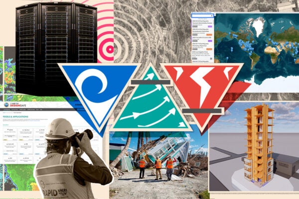
DesignSafe has three core components:
- Data Depot
- Tools and Applications for cloud-based simulation and analytics
- Reconnaissance Portal for field research data
Researchers rely on the Data Depot repository for robust data management, curation and publication. To date, it hosts more than 1,800 published datasets and over 50 million files, which have been accessed more than 800,000 times during the past decade — demonstrating its critical role in supporting open, reusable and impactful natural hazards research.
“We see natural hazards data not only being collected but being published and available to the broader research community to accelerate research discoveries,” Rathje said.
On the computational side, DesignSafe provides access to software tools and applications at TACC that enable researchers to couple their data with computational simulation, AI and machine learning to further accelerate discoveries.
“These tools can reduce the impact of natural hazards on the built environment and our communities,” Rathje added.
The Reconnaissance (Recon) Portal is a dynamic, interactive map that geospatially organizes worldwide reconnaissance data from natural hazard events, enabling rapid access to data collected by other NHERI components, such as the NHERI RAPID reconnaissance facility and the CONVERGE Extreme Events Reconnaissance (EER) teams. These data document the impact of natural hazards on the built environment, allowing researchers to learn from events to improve resilience of our communities in the future.
For more information about DesignSafe, visit designsafe-ci.org.


