
The University of Texas Libraries have completed a three-and-one half-year scanning project to make the Sanborn Fire Insurance Maps for Texas and Mexico (1877-1922) available online.
The 10,442 maps scanned primarily from the collection of the Dolph Briscoe Center for American History at The University of Texas at Austin — with additional maps being scanned at the Library of Congress, Maps and Geography Division in Washington, D.C. — become part of the Perry-Castañeda Library Map Collection.
The Sanborn maps are large-scale maps of major cities and towns. The information on the maps, which were published to determine fire insurance risks of particular buildings, now has many uses for historians, urban planners, architects, social scientists, geographers, genealogists, environmentalists and anyone interested in the history and growth of cities.
Detailed features of the maps include the shape and size of residential and commercial buildings, street addresses, block numbers and property boundaries. The type of construction (by color coding), type of roof, building height, location of windows and doors, proximity to fire hydrants and alarm boxes are also included. For many cities, multiple editions of a map allow for the study of change over time for a particular area.
Founded in 1867 by D. A. Sanborn, the Sanborn Map Company was the primary American publisher of fire insurance maps for nearly 100 years. The company is now owned by Environmental Data Resources Inc.
The largest library collection of the historical Sanborn maps is in the Library of Congress, Maps and Geography Division. The Library of Congress sent duplicate state sets of maps to each state, with the Texas maps going to the Dolph Briscoe Center for American History.
Sample Maps:
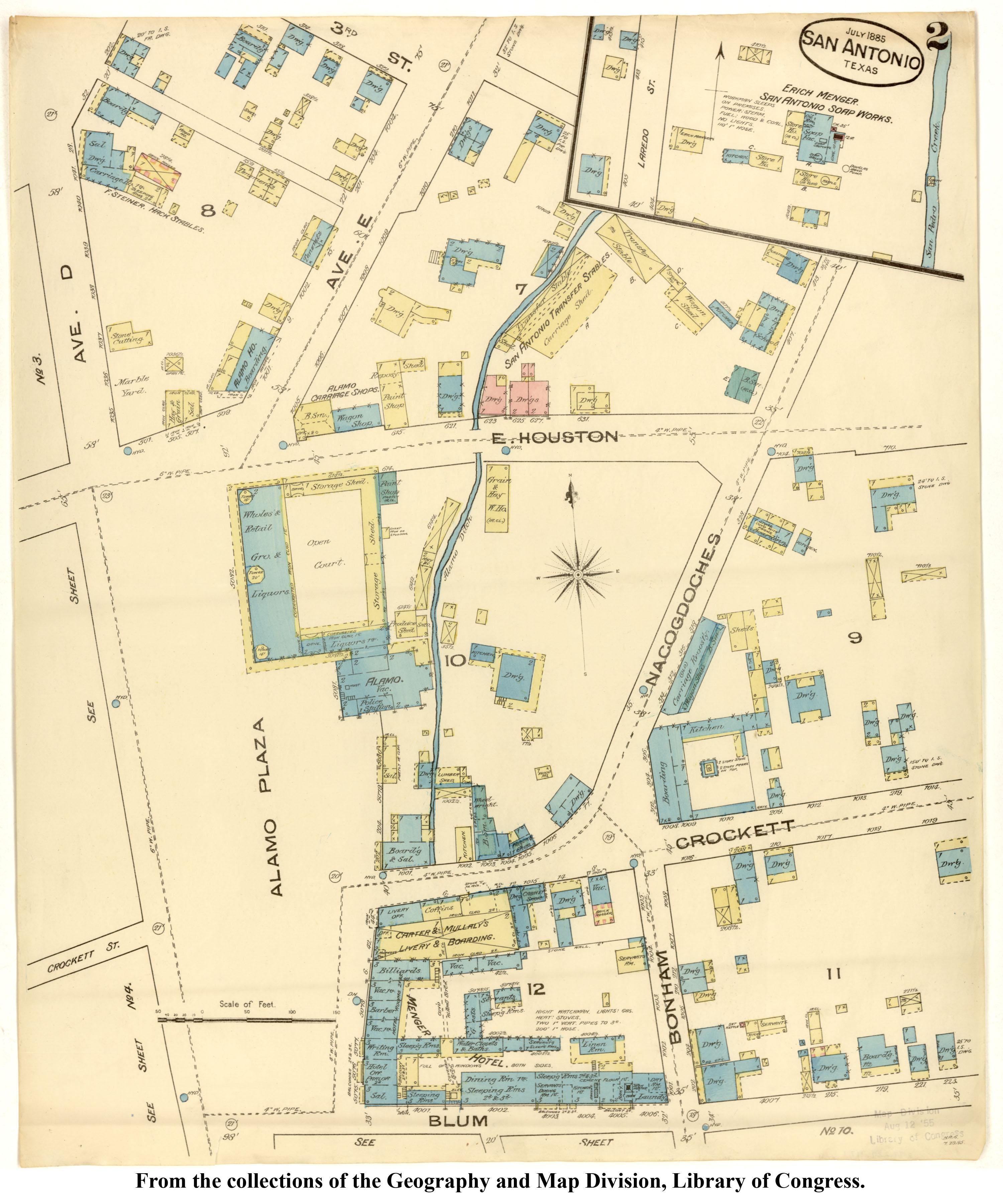
The Alamo (San Antonio) 1885
http://www.lib.utexas.edu/maps/sanborn/san_antonio_1885_2.jpg
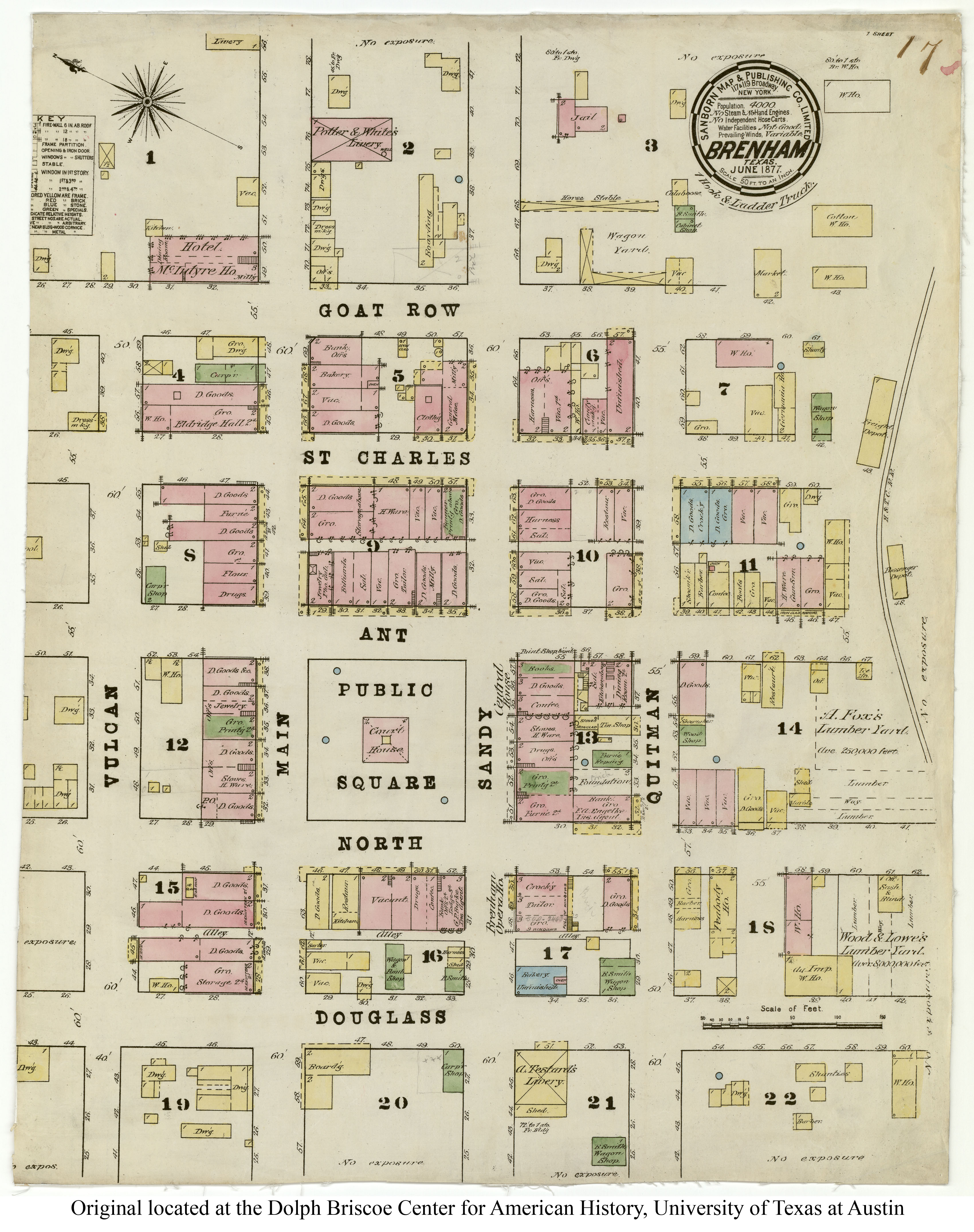
Brenham, Texas 1877
http://www.lib.utexas.edu/maps/sanborn/txu-sanborn-brenham-1877-1.jpg
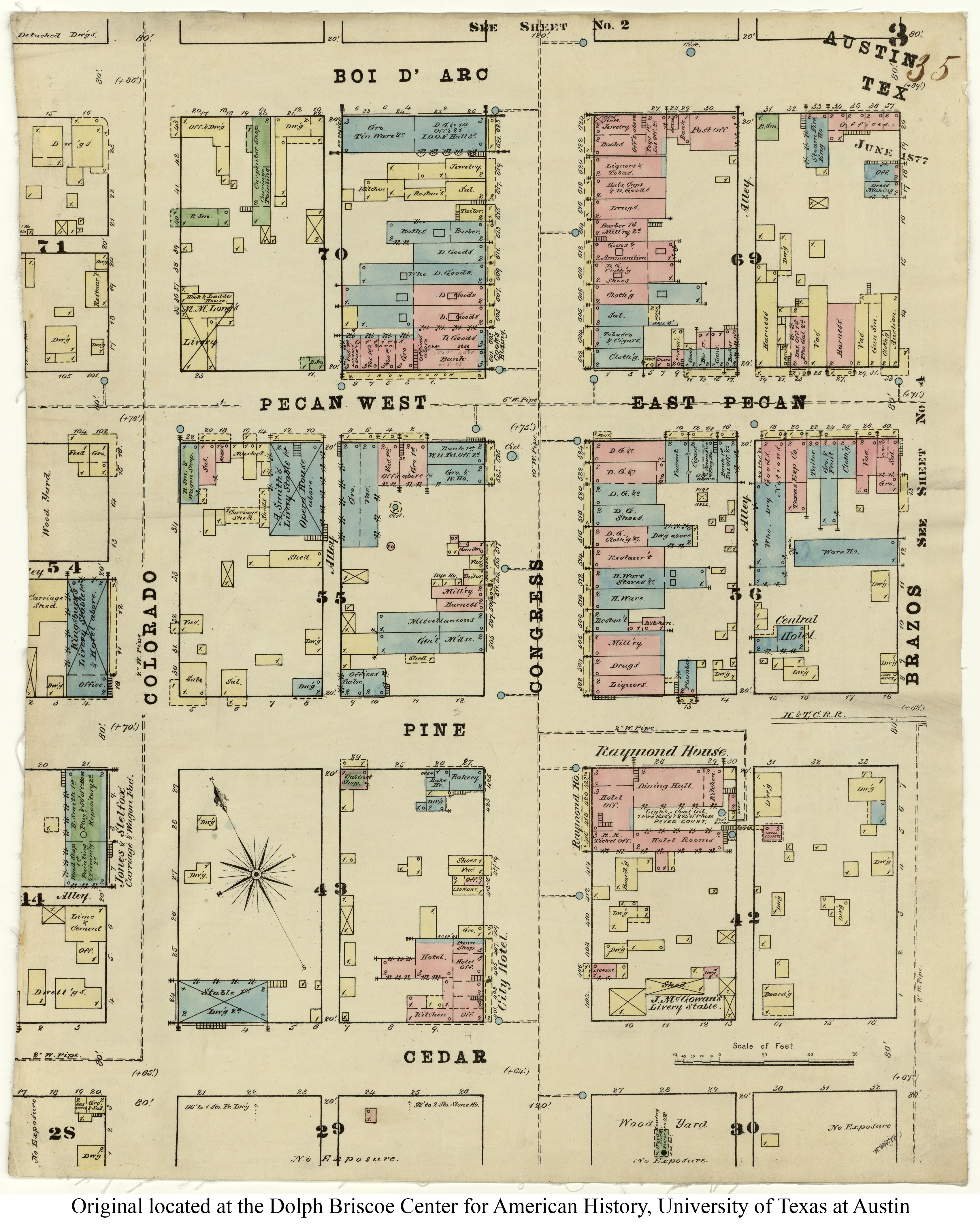
Pecan Street (Sixth Street) and Congress Avenue, Austin 1877
http://www.lib.utexas.edu/maps/sanborn/txu-sanborn-austin-1877-3.jpg
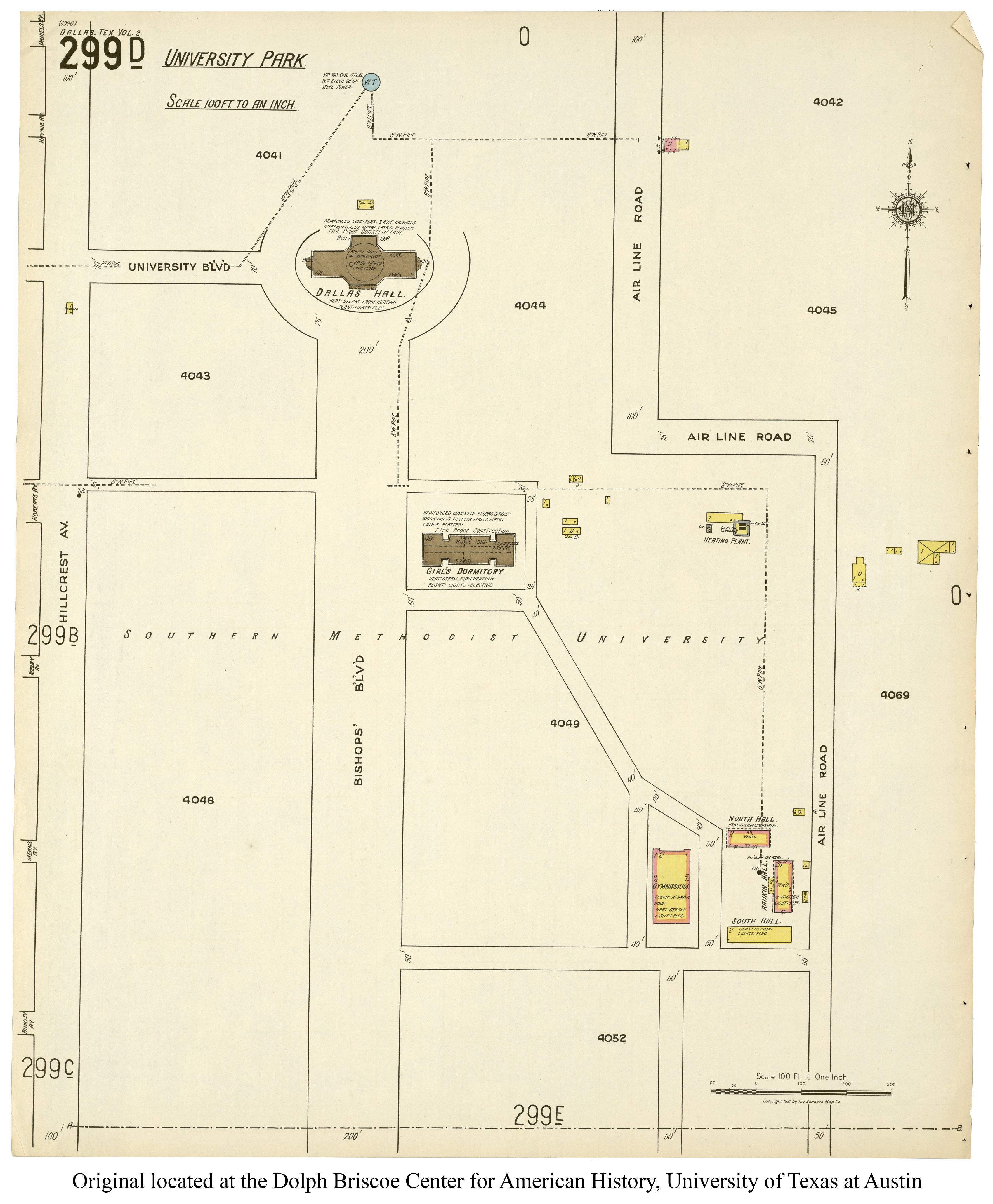
Southern Methodist University campus (Dallas) 1921
http://www.lib.utexas.edu/maps/sanborn/d-f/txu-sanborn-dallas-1921-299d.jpg
The full color Sanborn fire insurance maps are available at:

