
 Texas is a beautiful state full of surprising geography, from striking red canyons to natural swimming holes. Experts from The University of Texas at Austin have compiled a “must-see” list for fans of Southwestern landscapes. “Great Places to View Texas Geology” is a travel booklet developed by UT’s Bureau of Economic Geology to help nature fans discover the most distinctive geologic sites throughout the unique regions of Texas.
“We wanted the typical traveler to Texas, and our own citizens, to have a little better understanding of why our state has so many beautiful vistas and natural features,” said Mark W. Blount, who adapted the booklet from the bureau’s comprehensive “Texas Through Time” geologic overview. “Texas has been shaped over millions of years by geologic processes – oceans, volcanism and the formation and movement of the rocks below its surface. The result has been the creation of these fantastic places to see, to enjoy, and, with this new travel pamphlet, to understand.”
“Great Places to View Texas Geology” includes more than 50 destinations with maps, historical background and geological descriptions. This travel booklet will soon be available for $10 at gift shops and book stores throughout Texas. It is available now through The Bureau Store online.
Here are nine of the top spots for exploring the natural wonders of Texas.
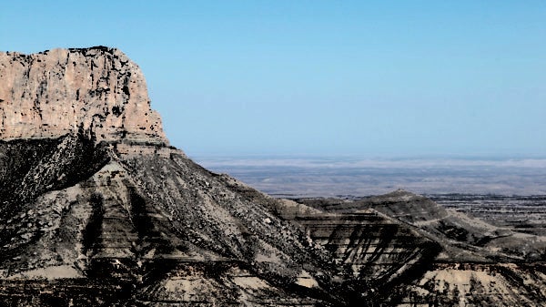
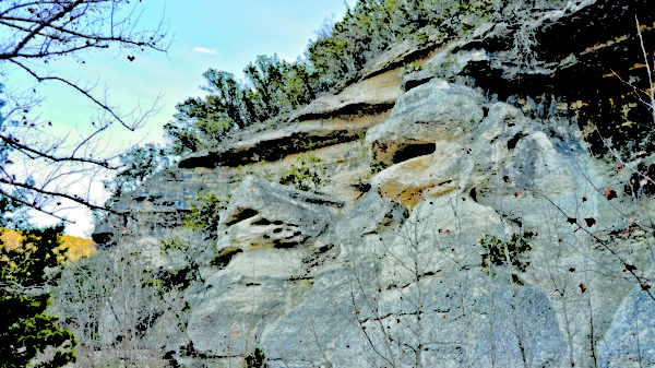
Guadalupe Mountains: El Capitan Area
The Guadalupe Mountains expose what could be the finest cross section of an ancient marine reef complex on Earth. The Capitan Reef forms tall, massive cliffs on the canyon walls, together with the shallow-water limestone reefs visible high on the mountaintops and the deepwater marine limestones and sandstones of the foothills.
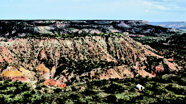
Palo Duro Canyon
Palo Duro Canyon is a great gash in the Texas Panhandle cut by the Prairie Dog Town Fork of the Red River. It is called the “Grand Canyon of Texas” because of its majestic size and its colorful rock layers. It is the nation’s second-largest canyon behind only the Grand Canyon.
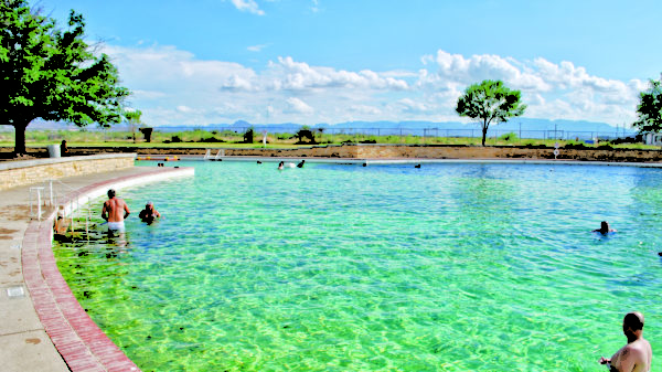
San Solomon Springs and Toyahvale
Located within Balmorhea State Park, the San Solomon Springs pool is the world’s largest spring-fed swimming pool, covering an area of 1.75 acres.
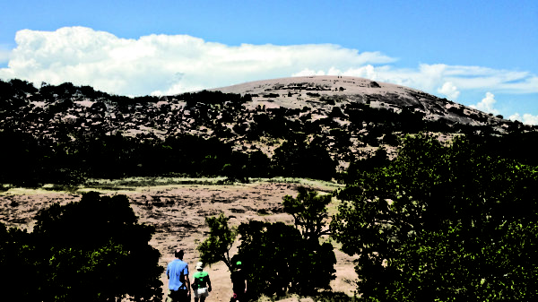
Enchanted Rock
When Native Americans heard eerie groans and pops coming from the huge granite dome that commands the Central Texas landscape, they thought it was the home of mystical beings, hence the name “Enchanted Rock.” Enchanted Rock is a part of a huge mass of granite 12 miles across and 20 miles long.
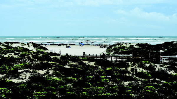
Padre Island
Padre Island National Seashore occupies 70 miles of the longest undeveloped barrier island in the world and hosts pristine beach, dune and tidal-flat environments.
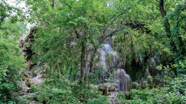
Colorado Bend
Gorman Falls in Colorado Bend State Park is a massive tufa deposit with spires and other unusual rock structures, lush ferns and moss, and countless waterfalls — an incredibly beautiful place.
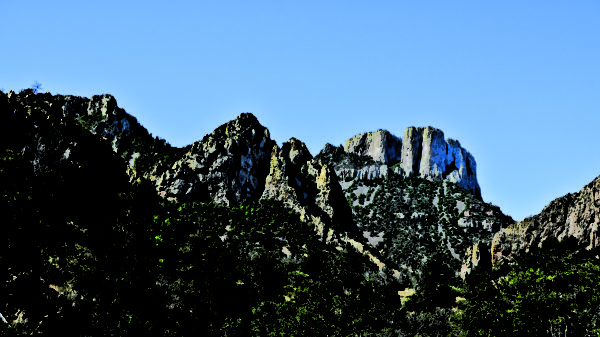
Chisos Mountains
Big Bend National Park’s Chisos Mountains host a unique oasis in the stark desert landscape, a “sky island” of pine and juniper forest nestled among the peaks.
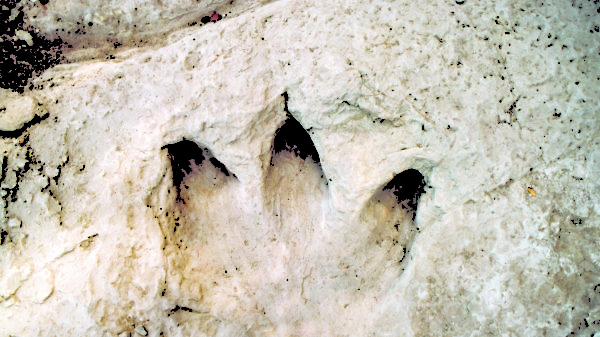
Glen Rose Area
Dinosaur footprints and trackways have been found in at least 50 places in the Glen Rose area, where moments in time were frozen in the rocks.
Lost Maples and Frio Valley
When seeking the striking reds, oranges and yellows of fall foliage, Texas might not be the first place that comes to mind. But during the fall, the bigtooth maple and Texas red oak trees of Lost Maples State Natural Area rival New England for fall color.
Established in 1909, the Bureau of Economic Geology is the oldest organized research unit of The University of Texas and is the Texas State Geological Survey. Its mission is to serve society by conducting objective, impactful and integrated geoscience research on relevant energy, environmental and economic issues. Its vision is to be a trusted scientific voice to academia, industry, government and the public, whom it serves. The Bureau is part of the Jackson School of Geosciences at The University of Texas at Austin.